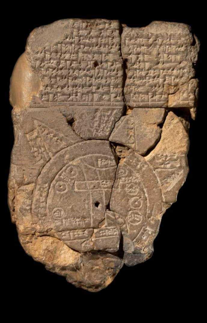
The Babylonian Map of the World, also known as Imago Mundi, is the oldest tablet clay map written in Akkadian. It dates back to the 6th century BC.
It was discovered at Sippar, southern Iraq, 60 miles (97 km) north of Babylon on the east bank of the Euphrates River.
The clay tablet resides at the British Museum.
Objects on the Babylonian map of the world:
1. “Mountain” (Akkadian:šá-du-ú)
2. “City” (Akkadian: uru)
3. Urartu (Armenia) (Akkadian: ú-ra-áš-tu)
4. Assyria (Akkadian: kuraš+šurki)
5. Der (Akkadian: dēr)
6. Swamp (Akkadian: ap–pa–ru)
7. Elam (Akkadian: šuša)
8. Canal (Akkadian: bit-qu)
9. Bit Yakin (Akkadian:bῑt-ia-᾿-ki-nu)
10. “City” (Akkadian: uru)
11. Habban (Akkadian: ha-ab-ban)
12. Babylon (Akkadian: tin.tirki), divided by Euphrates
13. Ocean (salt water, Akkadian:idmar-ra-tum)
Mythological objects.
#archeologynews